Hindhead Commons and the Devil’s Punchbowl
Waverley
Type:Viewpoint
Tel: +44 (0)1428 604040
Waverley
Tel: +44 (0)1428 604040

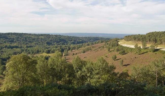
Discover the beautiful Devil's Punch Bowl, a 282 hectare open heathland and a Site of Special Scientific Interest, situated just to the east of the village of Hindhead in Surrey. Designated as an Area of Outstanding Natural Beauty (AONB), the breath-taking scenery, stunning views and hidden surprises make this an ideal destination for walkers and familes a like.
Look out for the grazing cattle and wild ponies, the old A3 road that once passed around the Devils Punchbowl (marked with its own sign), the shady woods and colourful trees. Why not head out along the 4.5 mile walk that takes you around the top of the punchbowl. This is generally better in the winter when the view are not obstructed by the trees.
There’s plenty of space for family adventures and some lovely picnic spots too You can pop into the Devils Punchbowl cafe serving light bites, hot food and drinks. This site and cafe are managed by the National Truse. Toliets are also available here when the cafe is open.
Parking is available Devils Punch Bowl car park.
Why is it known as the Devils Punchbowl?
The legend is that the Devil scooped up a handfuls of earth tormenting the god Thor and hurling it at him, leaving a great depression/hole that you can see today,
Why can you see the old A3 road whilst visiting the Devils Punchbowl?
In 2011, the Hindhead Tunnel was built to allow traffic to pass under the Devils Punch Bowl rather than around it, joining up the A3 all the way from London to Portsmouth. This enhanced the character of the area making it a major attraction for walkers and sightseers who can enjoy the peace of the heath and woodland.
An award winning Museum in the heart of Haslemere with remarkable collections of natural…
The Sculpture Park has been open to the public from April 2003 and has been an ongoing…
The highest point in West Sussex and the South Downs National Park, the views from the…
Located half way between Haslemere and Godalming in the heart of the Surrey Hills, Wessex…
The green flag award-winning Frensham Great Pond and Common are located between Farnham…
Mature woodland garden of over 25 acres. Flowering shrubs and wild flowers especially…
The common is an area of woodland and heathland which was used as an army camp in both…
Flora Thompson, of Lark Rise and Candleford fame, inspired this circular walk on Weavers…
Visit us in Tilford village in the Surrey Hills and discover our ancient heritage and…
Old Thorns magnificent championship golf course ranges across the rolling hills of the…
Just 4 miles south of Farnham, and close to Guildford, you can find us in Alice Holt…
Once famous for its oak trees which supplied timber for navy ships, Alice Holt is managed…
Get ready for an enchanting family-friendly adventure at Birdworld, where visitors of all…
Farnham Pottery lies just a short distance from the centre of Farnham, situated in the…
Godalming Museum tells the story of Godalming and the surrounding area and includes a few…
Established in the twentieth century, this hillside arboretum has now been maintained by…